Hutton, Ryan: A Socioecological Approach to Identify Coastal Protection Zones for Vulnerable Coastal Communities – Sayreville South River
Title: A Socioecological Approach to Identify Coastal Protection Zones for Vulnerable Coastal Communities – Sayreville South River
Name: Ryan Hutton
Major: Geography
School affiliation: School of Arts and Sciences
Programs: Aresty – RA Program
Other contributors: Johnny Quispe, Jean Marie Hartman
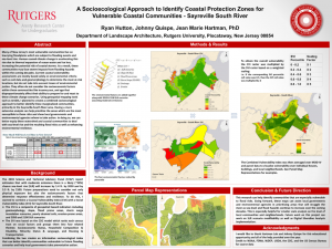
Abstract: Many of New Jersey’s most vulnerable communities live on low-lying floodplains which are subject to flooding events and sea-level rise. Human caused climate change is accelerating this rise due to thermal expansion of ocean water and ice loss, increasing the potential risk of coastal storms. As a result, these communities may face severe impacts from flooding hazards within the coming decades. Current coastal vulnerability assessments are mostly based solely on environmental criteria such as soil data and geomorphology to determine the most at-risk locations, but do not take into account issues of environmental justice. They often do not consider the socioeconomic factors within these communities like income,race, and age that disproportionately affect their ability to prepare for and react to these climate change scenarios. Using geospatial mapping tools such as ArcGIS, I planned to create a combined socioecological approach to better identify these marginalized communities, primarily in the Sayreville-South River area. Having a more extensive analysis can help prioritize the areas which are the most susceptible to these risks and show local governments and environmental agencies where to take action. In doing so, we can better equip these watershed and coastal communities to deal with sea-level rise and the resulting flood risks as well as enhancing environmental resilience.