Kyle Comito : Determining Landslide Susceptibility in the Cordillera Talamanca, Costa Rica
Title: Determining Landslide Susceptibility in the Cordillera Talamanca, Costa Rica
Name: Kyle Comito
Major: Civil & Environmental Engineering
School affiliation: School of Engineering
Programs: Aresty – RA Program
Other contributors: Rosa Martinez, Paulo Ruiz
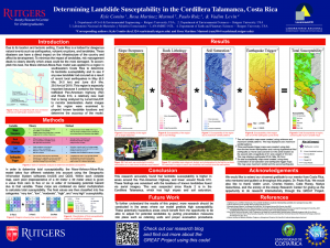
Abstract: Due to its location and tectonic setting, Costa Rica is a hotbed for dangerous natural events such as earthquakes, volcanic eruptions, or landslides. These disasters can have a direct impact on the infrastructure of the country and affect its development. To minimize the impact of these events, risk management deals to clearly identify which areas could be most damaged. To accomplish this task, heuristic models with different variables are used. As a result, they show the areas that are most susceptible to certain events. Herein, this research focuses on mass movement events and uses variables such as slope steepness, rock lithology, and soil saturation, and potential triggering from earthquakes. The Mora-Vahrson-Mora-Ruiz model takes all of these variables into account to determine the total landslide susceptibility of an area. This model was applied to a region in southeastern Costa Rica to determine its landslide susceptibility and to evaluate if any new landslide had occurred as a result of recent local earthquakes in May (6.0 MW, 24.0 km) and June (6.4 MW, 29.0 km) of 2019. This region is especially important because it contains the heavily trafficked Pan-American Highway (R2) and Route 613, a relatively new road that was analyzed to monitor deterioration by LanammeUCR. Individual maps were created depicting the susceptibility of the region due to each variable. Aerial images of the region were examined to pinpoint known landslide locations and determine the accuracy of the model. The combined variable maps show high susceptibility of areas in the vicinity of R2 and at points of the Cordillera Talamanca mountain range, which suggest further work be done to help better understand the hazard posed at these locations.
